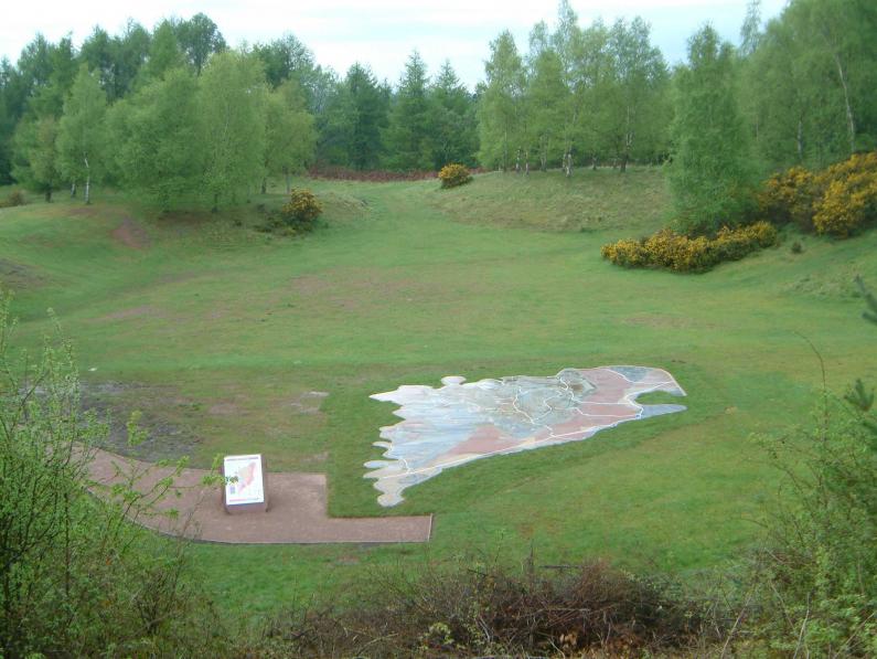
At New Fancy you can see the unique Geomap, which celebrates both the geological and the industrial history of the Forest of Dean. The map represents the geology of the Forest of Dean. Each layer of rock shown on Geomap is made from the actual rock it represents, taken from local quarries.
Overlain on the map is the industrial history. It shows the location of 102 collieries, 35 iron mines and 49 stone quarries, as well as the main railway lines and three long-lived tramroads that were so important for the expansion of these industries in the nineteenth century.